Things to Do in El Bolsón: A Hiking Guide to the Best Mountain Refugios
We wrote this guide in Spanish and translated it with the help of AI. Leer en castellano
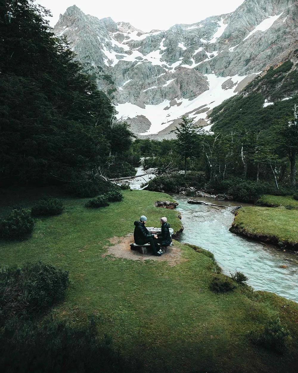
Wondering what to do in El Bolsón? This corner of Patagonia is famous for its refugios (mountain huts), its trails through the forest and its stunning views. In this guide we tell you all about the most beautiful hikes, how to get to the refugios, and what to know if it's your first time in the area.
This article has affiliate links: if you book or buy through them, we earn a commission at no extra cost to you.
When to go to El Bolsón
The best times to go to El Bolsón are spring (September to November), summer (December to February) and fall (March to May). In those months the weather is milder and better for being outdoors and visiting the refugios. Even so, conditions change, so we recommend bringing clothes and footwear that can handle rain, wind and low temperatures.
Also keep in mind that several of the refugios we list below usually close during the winter months.
Where is El Bolsón?
El Bolsón is in Río Negro province, in Argentine Patagonia. It sits in the lower valley of the Río Azul, surrounded by mountains, about 120 km south of San Carlos de Bariloche.

Travel with peace of mind with Heymondo travel insurance
Get your travel insurance on Heymondo (opens in a new tab)
This is an affiliate link: if you book or buy through it, we earn a commission at no extra cost to you.
Refugios of the Comarca Andina in El Bolsón
El Bolsón has one of the largest networks of mountain refugios in South America. They're strategically placed so you can link different treks and explore the whole region.
So, what is a refugio?
A refugio is a cabin in the middle of the forest that offers hikers lodging and services during the tourist season. Inside, usually in the loft, there are shared sleeping areas. These are generally heated and have mattresses on the floor where you lay out your sleeping bag. The other option is to camp near the refugio. Either way you pay the refugio for your spot, and camping is generally cheaper.
Besides lodging, refugios offer other services. They sell food such as homemade bread, tortas fritas (fried dough), drinks and cooked meals for dinner. Some even brew their own craft beer. You can also buy supplies at their camp stores. Other services include charging electronic devices and showers, which also cost extra.
What's available varies from one refugio to another. When you plan a visit, we recommend looking up current information on what each one offers and what it charges. Almost all of them have an Instagram account where they post information.
You can reach the refugios from two main points:
- Wharton: 14 km from El Bolsón. Keep in mind that the trails don't actually start in Wharton but at the confluences (las confluencias), about 2 km (1.2 miles) away. Only 4x4 vehicles can get as far as the confluences, so most people start walking from Wharton.
- Doña Rosa: 6 km from El Bolsón.
Which one suits you better depends on the refugio you want to visit.
You can get to both points by public bus (they don't run very often) or by taxi, and if you have a car, there's parking where you can leave it.

Rent a car to get around El Bolsón
Rent a car on DiscoverCars (opens in a new tab)
This is an affiliate link: if you book or buy through it, we earn a commission at no extra cost to you.
Hiking circuits through the refugios: what to do in El Bolsón
There are several circuits you can hike, depending on how many days you have, how demanding you want it to be and your own preferences.
Most refugios don't require a reservation, so you're free to change your plans as you go, like staying an extra night at a refugio you liked or just taking a rest day. That said, you have to carry enough food for the days you plan to be up there, plus cash to pay for the refugios and/or meals. Also make sure someone knows which days you'll be in the mountains, since there's no cell signal.
This photo of the map of the El Bolsón refugios shows several examples of circuits you can do.
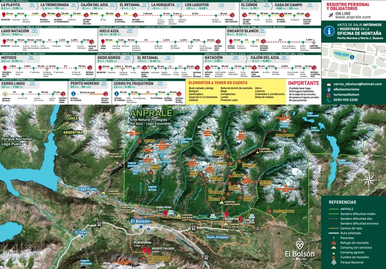
We had 4 days in El Bolsón: Refugio Hielo Azul - Refugio Lago Natación - Refugio Cajón del Azul.
Important things to keep in mind
Before setting out on any trail, you have to register online at this link.
And don't forget to tell someone you trust where you'll be and which days you plan to spend in the mountains, since you won't have cell signal.
⚠️ Fires are prohibited in the Río Azul - Lago Escondido protected area. For your own safety, don't stray from the circuits, and only visit places that are open to the public. Out of respect for nature and for the rest of us who come here, don't use speakers, and remember to bring a bag for your trash (everything that goes up the mountain with you comes back down with you). Pets aren't allowed.

See all the places to stay in El Bolsón
Book your stay on Booking (opens in a new tab)
This is an affiliate link: if you book or buy through it, we earn a commission at no extra cost to you.
Refugios in El Bolsón
Here's a list of the refugios, with their distances and the services they offer. Remember to check availability and any changes to this information before you go.
1. Refugio La Playita
This is the first of the 8 refugios along the banks of the Río Azul and the main circuit (circuito troncal) in El Bolsón. It's known as one of the most accessible refugios in terms of difficulty and distance.
Distance from Wharton: 8 km (5 miles). About 2.5 hours on foot.
Difficulty: Easy to moderate
The refugio is open all year. You can spend the night inside (bring a sleeping bag) or camp, and it's also a great choice for a day visit. You'll find draft beer and home-cooked food, plus a kitchen with dishes and bathrooms with showers.
Walks from the refugio: To the Cajón del Azul, about 1 hour. There are also short walks to viewpoints and natural pools.
Here's the refugio's Instagram for more details.
2. Refugio La Tronconada
Next on the route is La Tronconada, on the riverbank, on the slopes of Cerro Dedo Gordo. It's just 30 minutes from La Playita: follow the same path upriver until you reach the turnoff that crosses the Río Azul on a footbridge.
Distance from Wharton: 9 km (5.6 miles). About 3-4 hours.
Difficulty: Easy to moderate
There's limited space for sleeping inside the refugio, and you have to bring a sleeping bag. It has a camping area, a bathroom, hot water for showers, a camp store and a kitchen with dishes.
Walks from the refugio: To the Cajón del Azul (30 minutes).
3. Refugio Cajón del Azul
This is one of the best-known refugios in El Bolsón, and a place many travelers dream of visiting. The setting is impressive: the Río Azul squeezes between high rock walls, and the scenery is beautiful. To get there, you walk about 30 minutes from La Tronconada.
Distance from Wharton: 10 km (6.2 miles). About 3-4 hours.
Difficulty: Moderate
The refugio is generally closed from April to October. It doesn't take reservations: visitors are received in order of arrival. It has shared rooms with mattresses (bring a sleeping bag), camping areas, bathrooms, hot showers, a shared kitchen with utensils, meals, and a small camp store where you can buy a few things. Charging electronic devices costs extra.
Walks from the refugio: You can walk to the source of the Río Azul.
Here's the refugio's Instagram for more details.
4. Refugio El Retamal
El Retamal is 1 hour past the Cajón del Azul, along the same path.
Distance from Wharton: 12 km (7.5 miles). About 5-6 hours.
Difficulty: Moderate
It usually opens in October and closes after Easter. There's a camping area and space to sleep inside (bring a sleeping bag). They serve meals, and there's a camp store and a kitchen with dishes for those sleeping inside the refugio. It doesn't take reservations.
Walks from the refugio: You can visit viewpoints such as Paso de los Vientos and Paredón de las Águilas, or the El Llanto del Ángel waterfall.
Here's the refugio's Instagram page for more details.
5. Refugio El Conde
It's 3 km (1.9 miles) from Refugio Cajón del Azul, about 1 hour and 45 minutes on foot. The trail passes Refugio La Playita, La Tronconada and the Cajón del Azul, and just before Refugio La Horqueta, where the Río Azul meets the Río Rayado, the path to El Conde branches off.
Distance from Wharton: 15 km (9.3 miles). About 4-5 hours.
Difficulty: Moderate
The refugio sleeps 25 people (bring a sleeping bag). It also has a camping area, a kitchen with dishes, hot showers and latrines.
Walks from the refugio: You can go to several viewpoints.
Here's the refugio's Facebook page for more details.
6. Refugio Casa de Campo
It's 20 minutes (1 km, or 0.6 miles) from Refugio El Conde, and it's the newest refugio of them all.
Distance from Wharton: 15 km (9.3 miles). About 4-5 hours.
Difficulty: Moderate
The refugio is open all year and you don't need a reservation. It has mattresses for sleeping inside (bring a sleeping bag), space to camp, electricity, showers and meals.
Walks from the refugio: You can walk to the Laguna de los Cueros viewpoint, the confluence of the Río Rayado, the viewpoint over the valley and Cerro Cigarro, and the headwaters of the Río Azul and Lago Esmeralda.
Here's the refugio's Instagram for more details.
7. Refugio La Horqueta
Continue for 1 more hour (3 km, or 1.9 miles) along the path past Refugio El Retamal. La Horqueta is in the Valle Azul, where the Río Azul meets the Río Rayado.
Distance from Wharton: 15 km (9.3 miles). About 4-5 hours.
Difficulty: Moderate to hard
The refugio is open from November to May. It sleeps 12 people inside (bring a sleeping bag) and has a camping area, a kitchen and a basic camp store, but no electricity.
Walks from the refugio: A few minutes from the refugio there's a wide beach with large natural pools.
8. Refugio Los Laguitos
Refugio Los Laguitos is the last refugio on the main circuit, about 10 km (6.2 miles) from Refugio La Horqueta. Expect another 4 to 6 hours of walking from La Horqueta. Because it's more remote and the area around it is so beautiful, we recommend staying 2 to 3 nights. Another option is to split the walk in two, since it's about 27 km (16.8 miles) from Wharton.
Distance from Wharton: 27 km (16.8 miles). About 10-14 hours.
Difficulty: Hard
The refugio has space to sleep inside and to camp, bathrooms, hot showers, a camp store, home-cooked meals, beer and more. It's usually open from November to April.
Walks from the refugio: The two big walks from here are best not done on the same day. The first goes to Cerro Año Nuevo and its panoramic view, 4 hours from the refugio. The other goes to Lago Soberanía, 3 hours from the refugio.
Here's the refugio's Instagram for more details.
9. Camping Los Mañios
This campground is between Refugio La Horqueta (about 2 hours away) and Refugio Los Laguitos (about 4 hours away).
Distance from Wharton: 19 km (11.8 miles). About 5 to 6 hours.
Difficulty: Moderate to hard
The campground is one of the least crowded on the main circuit. It has space to camp, bathrooms, and dorms with mattresses for your sleeping bag. They also make meals.
Here's the campground's Instagram for more details.
10. Refugio Hielo Azul
Refugio Hielo Azul is one of the best-known refugios in the area, and there are two ways to reach it: from Wharton and from Doña Rosa. From either one, the walk takes about 5 to 7 hours and covers 16 km (9.9 miles). After reading several blogs and asking around, we decided to go up from Doña Rosa, since it seemed to be the less demanding climb.
Distance from Wharton or Doña Rosa: 16 km (9.9 miles). About 5-7 hours.
Difficulty: Moderate
The refugio usually opens in spring and stays open until May, and it doesn't take reservations. It has mattresses for sleeping inside (bring a sleeping bag), space to camp, bathrooms, showers, electricity to charge phones, a basic camp store, meals and a quincho (covered shelter) for campers.
Walks from the refugio: You can visit the Hielo Azul Glacier, the summit of Hielo Azul (with technical gear) and the summit of Barda Negra (for experienced hikers).
Here's the refugio's Instagram for more details.
11. Refugio Lago Natación
It sits at 1,400 m (4,590 ft) above sea level on Cerro Hielo Azul. You can get there from Refugio Hielo Azul, which is 2 km (1.2 miles) or 45 minutes to 1 hour away; from Doña Rosa; from Wharton, 12 km (7.5 miles); or from the Cajón del Azul, 7 km (4.3 miles), the hardest way because of the climb.
Distance from: Doña Rosa 15 km (9.3 miles), Wharton 12 km (7.5 miles)
Difficulty: Moderate
The refugio usually opens in spring and stays open until April. It doesn't take reservations. It has mattresses for sleeping inside (bring a sleeping bag), space to camp, bathrooms, a kitchen with dishes, and showers. It also serves prepared meals and drinks.
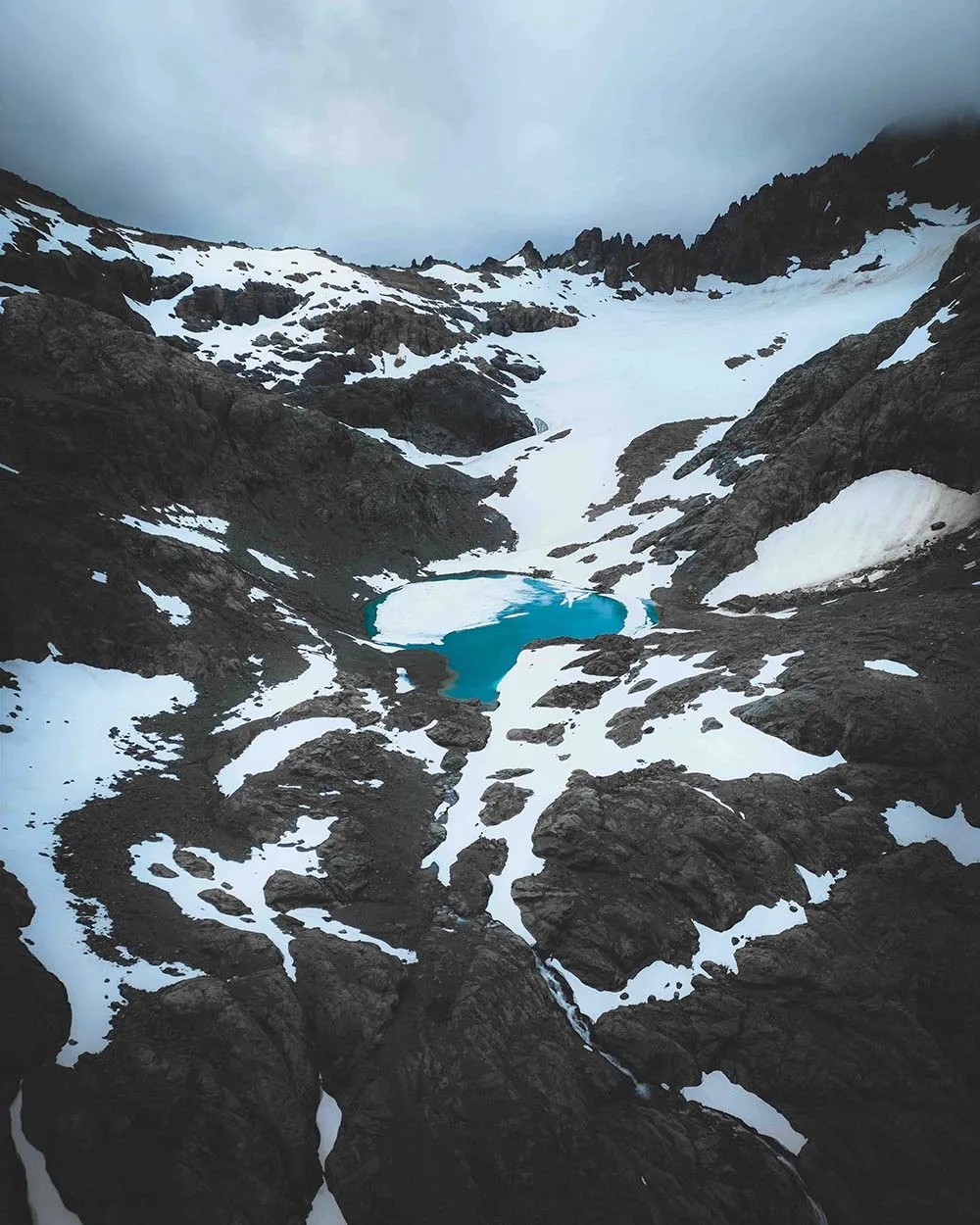
Walks from the refugio: You can do some long routes from here and some shorter ones. The short ones are the loop around the lake, the amphitheater and the ice caves that form in January (we don't recommend going in! Just look at them from the outside). The longer ones include the Cóndor viewpoint (3 hours), the summit of Hielo Azul (hard) and the summit of Barda Negra.
Here's the refugio's Instagram for more details.
12. Refugio Encanto Blanco
The trail to this refugio starts at the Tilleria family's farm, 2 km (1.2 miles) from the Wharton corner.
Distance from the Tilleria family farm: 8 km (5 miles), 3 hours.
Difficulty: Moderate
The refugio sits at the foot of Cerro Dedo Gordo and Cerro Perito Moreno, in the valley of the Río Encanto Blanco. There's space to sleep inside (bring a sleeping bag), a camping area, latrines, a hot shower and a basic camp store, and they make meals.
Walks from the refugio: Near the refugio there are several viewpoints and some waterfalls, and you can walk along the river beach. Experienced hikers can go to the source of the Río Blanco.
Here's the refugio's Instagram for more details.
13. Refugio Dedo Gordo
The trail starts in Wharton.
Distance from Wharton: 8 km (5 miles), about 4 hours.
Difficulty: Moderate to hard
The refugio has mattresses for sleeping inside (bring a sleeping bag) and a camping area by the stream. They make meals and there's a camp store. Use of the kitchen and dishes is included in the overnight fee.
Walks from the refugio: You can visit several viewpoints.
Here's the refugio's Instagram for more details.
14. Refugio Piltriquitrón
The trail starts at “La Plataforma,” which you can reach by car. This is the only refugio in El Bolsón with a view of the valley. Before you reach it, you pass through the carved forest (Bosque Tallado).
Distance from La Plataforma: 2 km (1.2 miles), 1 hour (it's very steep)
Difficulty: Moderate
The refugio has space to sleep inside and to camp. There's also a kitchen with dishes you can use, and they make meals.
Walks from the refugio: There are several hikes of varying difficulty. A viewpoint 45 minutes away looks out over El Hoyo, Lago Puelo, Epuyén and Cerro de Tres Picos. You can also climb 3 summits, which take longer: Piltriquitrón, Huemul and Oriental.
Here's the refugio's Instagram for more details.
15. Refugio Cerro Lindo
The trail starts at Camping Río Azul. It's best to head up early (by 2 in the afternoon at the latest) and not to go up on very windy days.
Distance from Camping Río Azul: 10 km (6.2 miles), 7 hours.
Difficulty: Hard
The refugio doesn't take reservations. It's the oldest refugio in El Bolsón, with wood heating and a wood-burning stove. It has bathrooms, a kitchen with dishes, and mattresses (bring a sleeping bag). They sell food, and there's a camping area.
Walks from the refugio: There are 2 hikes you can only do with a guide: to the summit of Cerro Lindo and to the Valle de los Perdidos.
Here's the refugio's Instagram for more details.
A day trip from El Bolsón
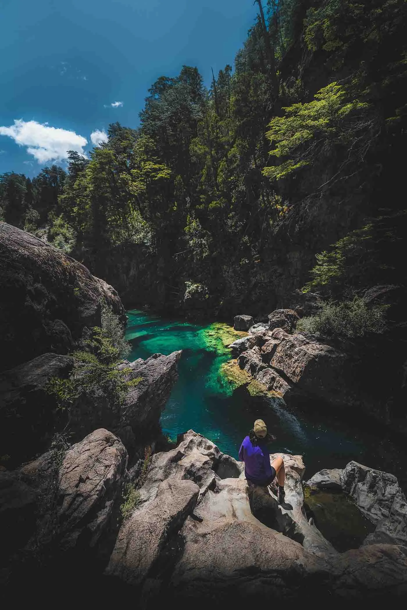
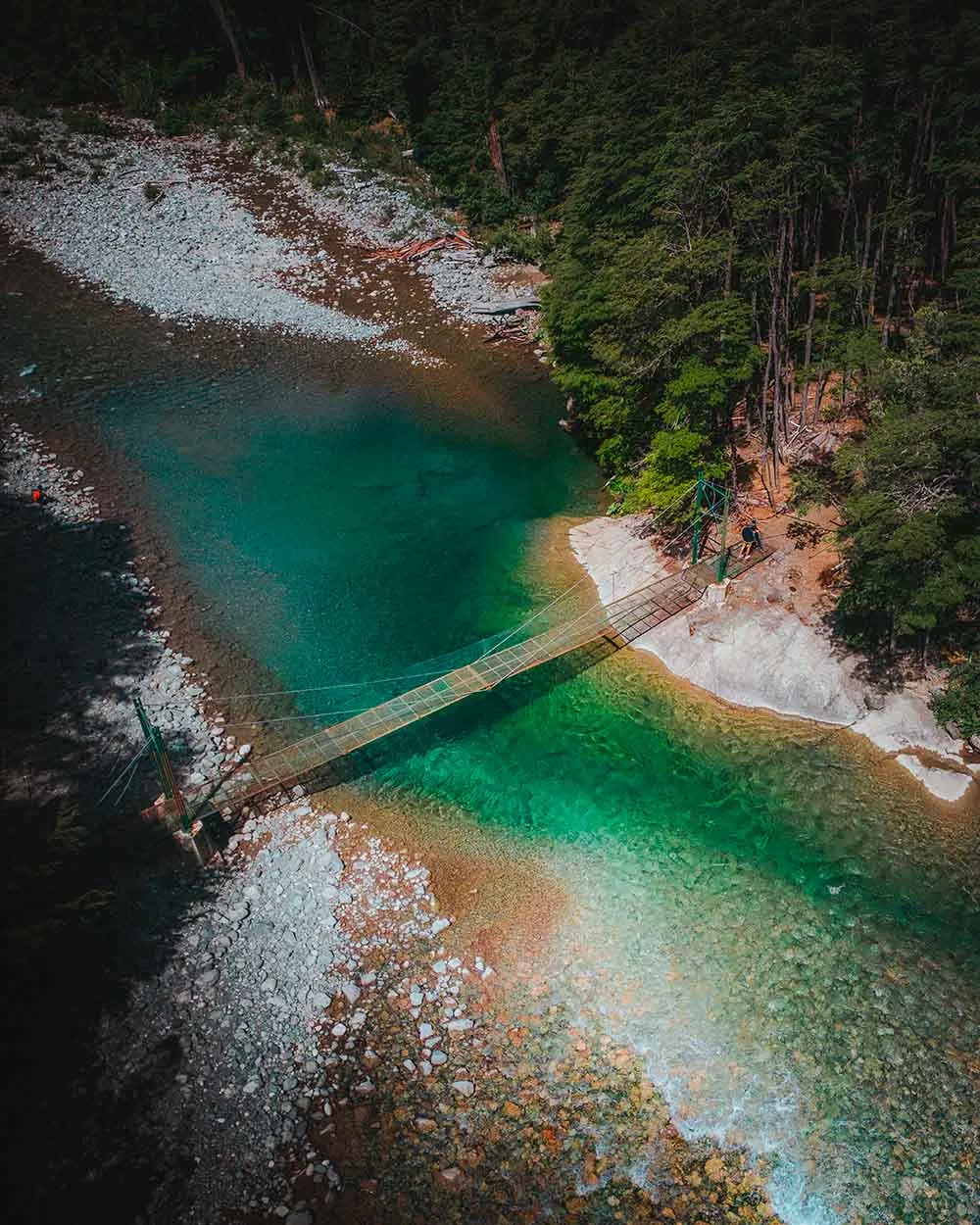
El Paraíso is a truly beautiful spot about 10 km from El Bolsón. You can reach this magical place from Camping Hue Nain or from Doña Rosa, walking about 30 minutes from there. Best of all, it's free and open to everyone, so you can enjoy nature at its finest.
Once you cross the suspension bridge, follow the path to the right to reach the beautiful pools along the Río Azul.
It's an ideal place for a day trip from El Bolsón.
What to bring and how to dress for hiking the El Bolsón refugios
We're no mountaineering experts, but we can share a list of what we took on our trip through the refugios and how we dressed.
For clothing, the key is to dress in layers, like an onion. The first layer should be thermal and breathable. Next comes a second layer to hold in your body heat, like a fleece, and a down jacket. Finally, the third layer should be waterproof and windproof, since it's what keeps the elements out.
On your feet, it's best to wear good-quality hiking socks and hiking shoes or boots with good grip. On your legs, you can wear thermal leggings with hiking pants or even another layer of leggings. Don't forget a cap, a wool hat, sunglasses and a fleece neck gaiter to protect you from the cold.
As for gear, we each carried a 60-liter backpack. Inside we packed an ultralight 3-season tent, a sleeping bag rated to 0°C, a headlamp, a first aid kit, a toiletry bag, sunscreen, a reusable water bottle, a trash bag, an extra change of clothes, a waterproof backpack cover in case of rain, snacks and cash for the refugios. We chose not to bring anything to cook with, since we decided to eat at the refugios. For food on the trail, we took nuts, fruit, granola bars and light lunches for the first few days, like empanadas and sandwiches. We also took trekking poles to make the trail easier going.
- Did a price or a detail change? Tell us at hello@charoandmarcos.com
- Still have a question? Ask us on Instagram (opens in a new tab)

Your next step

Salta and Jujuy Itinerary: A Complete 10-Day Guide to Northern Argentina
Planning a trip to northern Argentina and not sure where to start? In this guide we tell you what to do in Salta and Jujuy in 10 days, with…